Adding GeoNode Datasets to QGIS
You can add both vector and Raster data to QGIS using the QGIS GeoNode plugin.
Note: Make sure you access/search your data using basic authentication with your instance name and password or you will not be able to upload layer changes to your GeoNode.
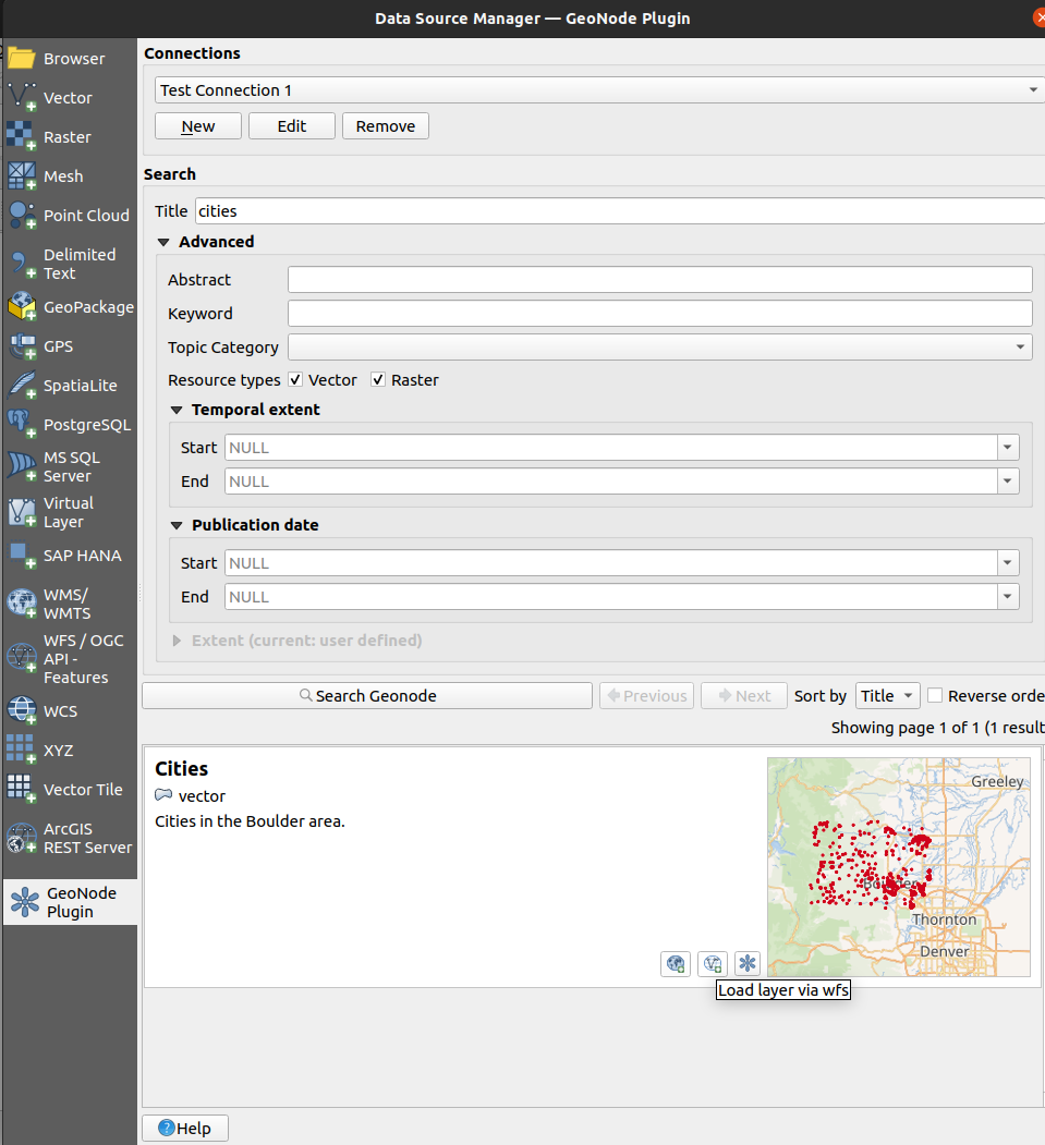
Once you have successfully searched for the city’s data using the searching data tutorial
Click on the
Load layer via wfsbutton to load the city point data into QGIS.
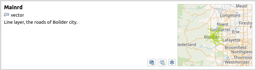
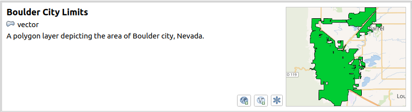
Using your knowledge search for and load the following datasets:
Mainrd
Boulder City Limits
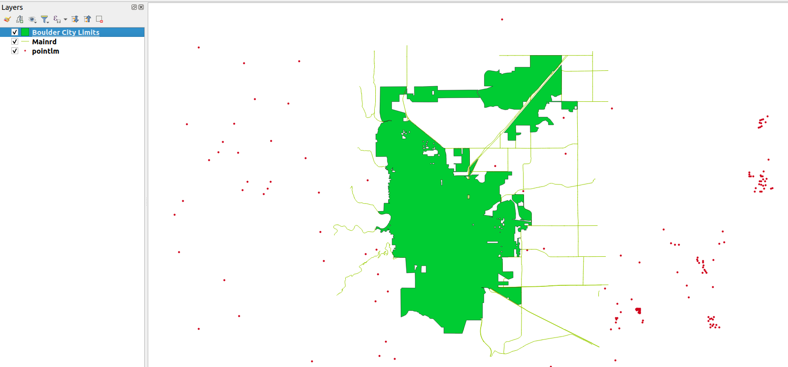
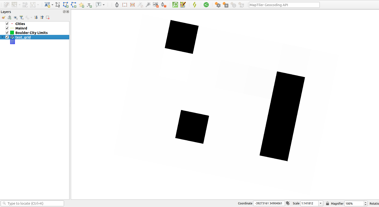
Once you have loaded the datasets into QGIS they will be available in the layer panel
You can also add raster data to the project using the Plugin
Go to the GeoNode tab of the Data Source Manager and search for test_grid as above
In the search result click on the
Load layer via wms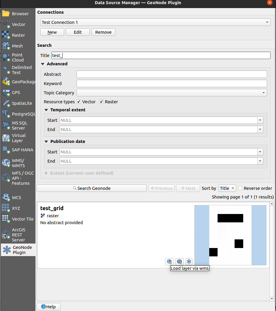
The raster data will be added to the map, right-click on the test_grid and select zoom to layer to see the layer.
Layer Information and Metadata
Datasets from GeoNode have their metadata automatically populated in QGIS from GeoNode.
To Inspect the layer metadata:
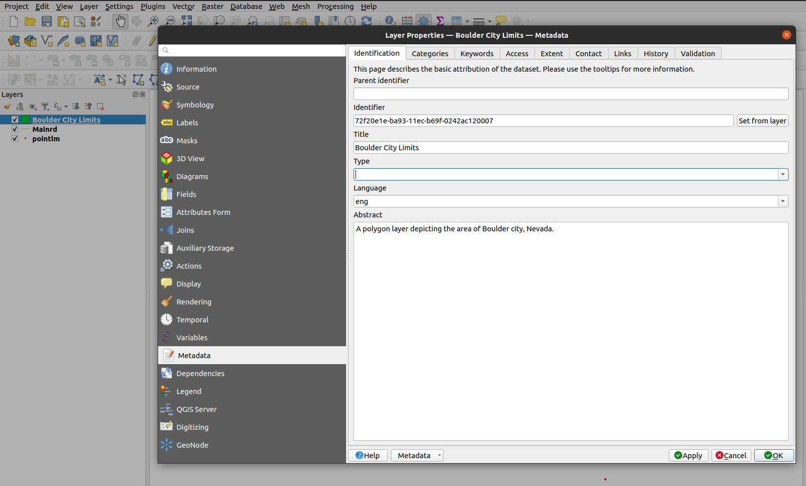
Double-click on the Boulder City Limits layer to open the layer properties dialogue
Click on the Metadata tab in the Layer Properties to view the metadata for the layer
If the relevant plugin capabilities are available for the detected GeoNode version, it may also be possible to modify some metadata fields and save them back to GeoNode. This can be achieved by:
Modifying the relevant metadata property by using the QGIS layer metadata section of the layer properties dialogue
Note: The current version of the QGIS GeoNode plugin is only able to upload the following metadata fields back to GeoNode:
-Title
-Abstract
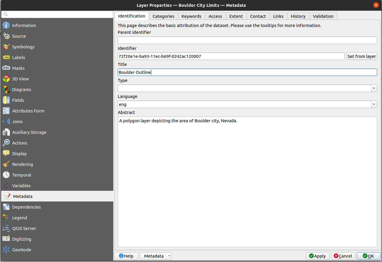
Change the title in the metadata to Boulder Outline and click the
Applybutton
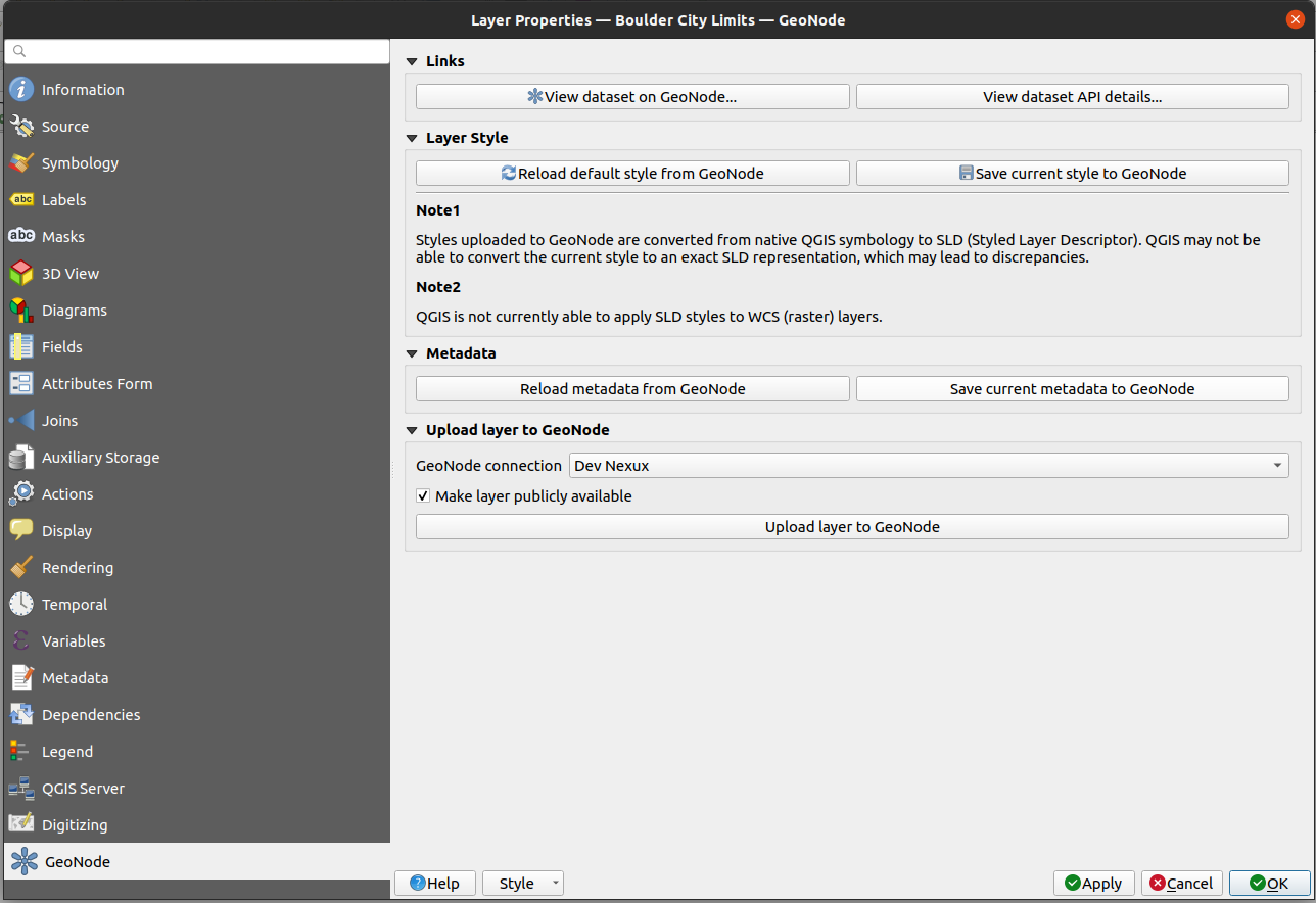
Click on the GeoNode tab of the layer properties dialogue and locate the Metadata group and click on the `Save current metadata to the GeoNode button. The plugin then proceeds to upload the metadata back to GeoNode.
Note: Uploading metadata back to GeoNode is an operation that requires your GeoNode connection to use authentication.