Styling dataset data
Depending on the dataset type and on the capabilities supported by the plugin for the detected GeoNode version, the plugin may be able to load a dataset’s symbology using the.
Note: GeoNode datasets export their symbology using the OGC Styled Layer Descriptor (.sld) format.
QGIS is not currently able to load SLD for raster datasets. Therefore, the QGIS GeoNode plugin is only able to style datasets that are loaded using the WFS vector provider or vector datasets. The plugin may also be able to modify the dataset symbology and upload it back to the remote GeoNode.
In this tutorial, we will style the following datasets we have used in previous tutorials.
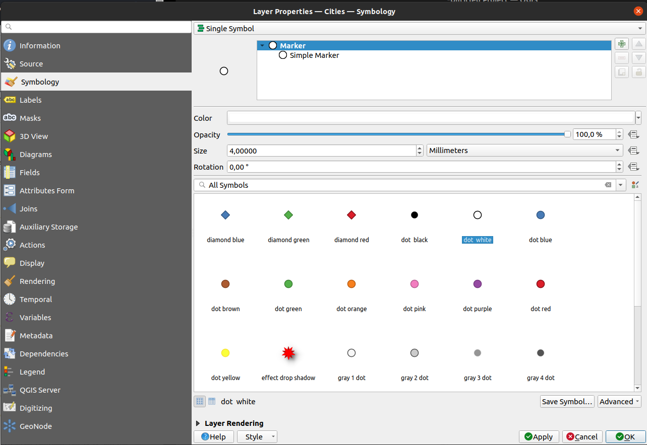
Cities
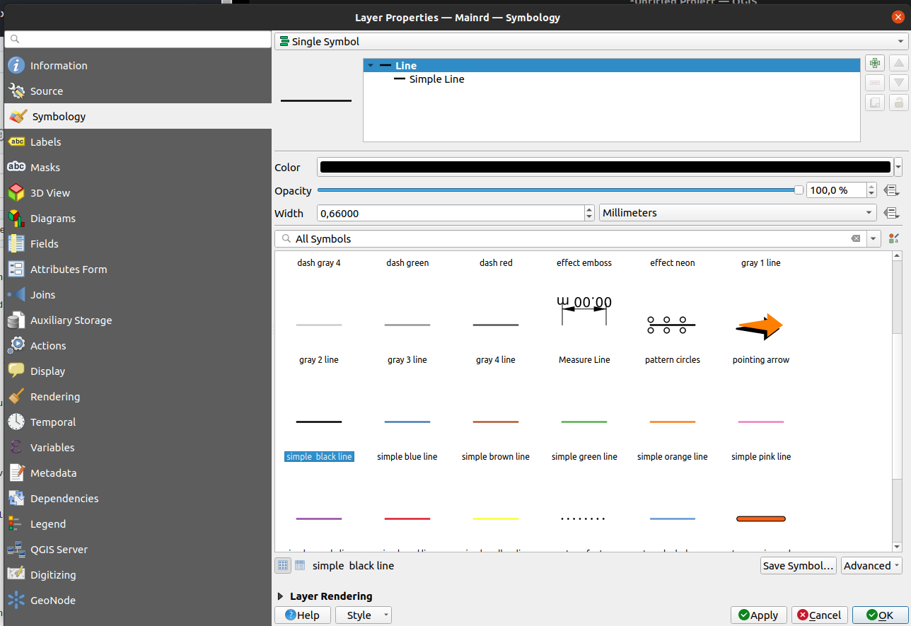
Mainrd
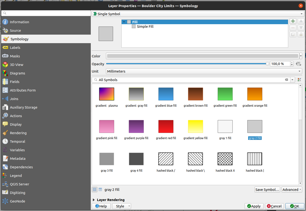
Boulder City Limits
Load the vector datasets into an empty QGIS project making sure to use the authenticated connection set up previously
Once the datasets are in the QGIS dataset pannel
Double click on the Boulder City Limits dataset and open the Symbology tab and choose the gray fill
Click ok
Style the other datasets in the following manner:
Mainrd: simple black line
Cities: dot white
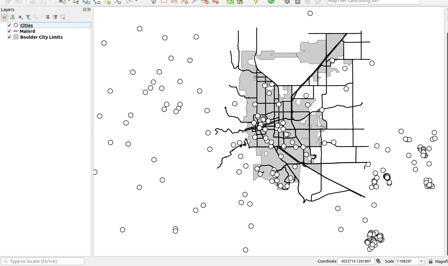
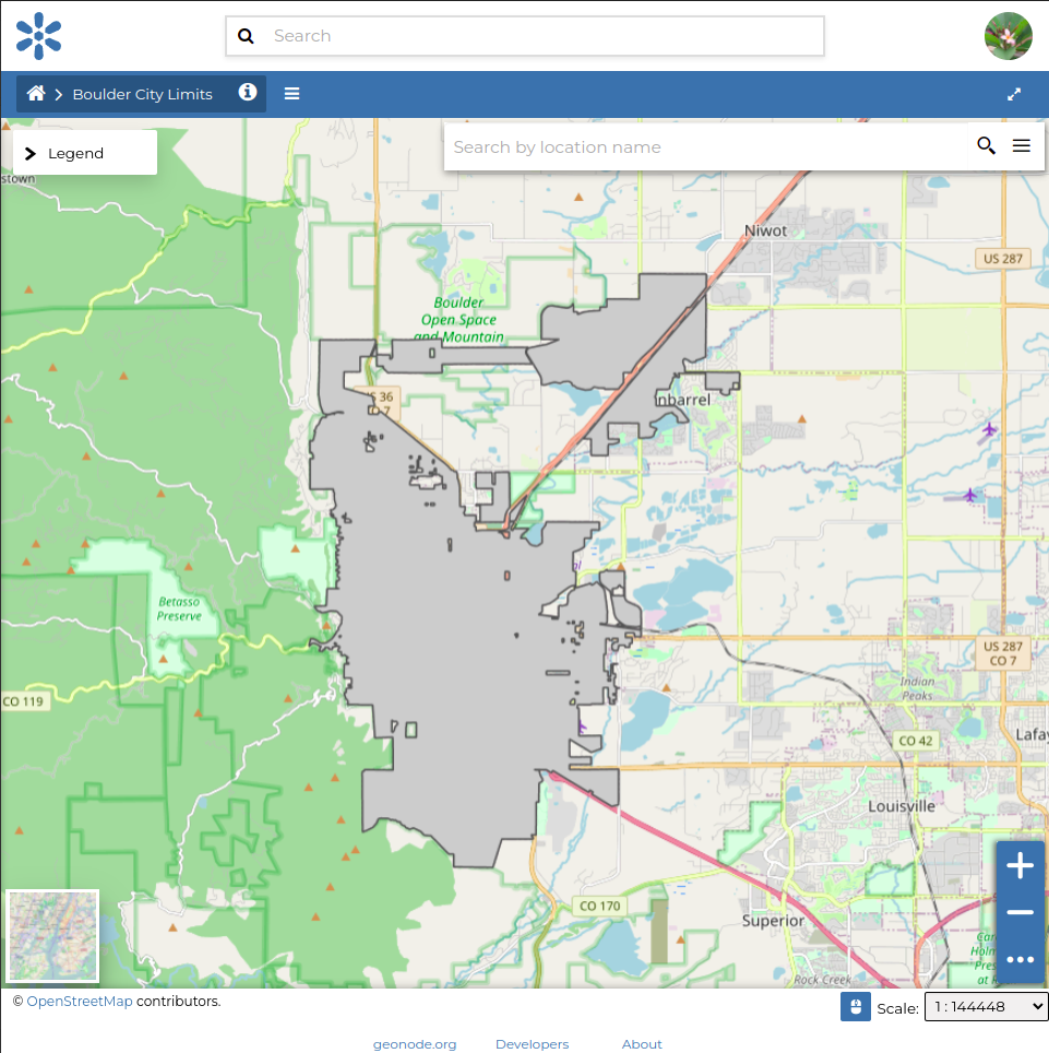
You will end up with a monochrome map
Navigate to the GeoNode section of the dataset properties dialogue for each dataset and locate the Layer style group
Click on the
Save current style to GeoNodebutton. The plugin then proceeds to upload the symbology back to GeoNode.
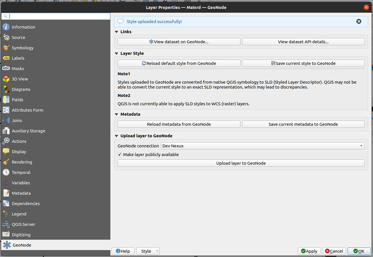
Navigate to your GeoNode instance and view the data and see if the style has updated.
Warning: Uploading symbology back to GeoNode requires an intermediary step whereby the QGIS native symbology is converted to OGC SLD, which is the format GeoNode understands. Unfortunately, it is currently not possible to perfectly match all. QGIS native symbology features to SLD. Therefore, the resulting exported symbology may differ from the original.
Note: Uploading symbology back to GeoNode is likely an operation that requires your GeoNode connection to use authentication.