Searching GeoNode
After having configured a GeoNode connection, you can use the plugin to search and load GeoNode datasets onto QGIS
Select the
Test Connection 1in the connections dropdownClick on the
Search Geonodebutton to view all the data sets available to you
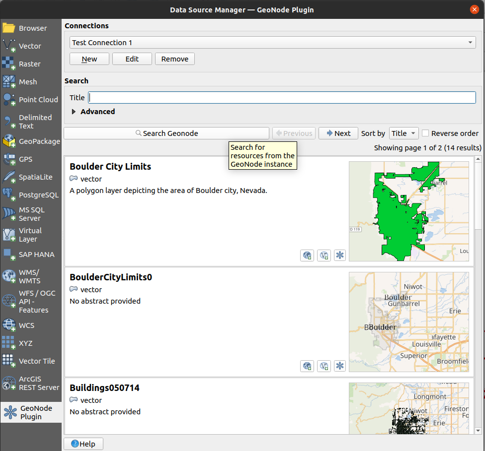
You can scroll through all the available data or use the Sort by dropdown or check the Reverse order box.
Make sure the Title field is chosen for sorting
Note: Sorting is performed by the remote GeoNode server. Therefore it must be parametrized
before actually searching the remote. If you wish to change the sort order after having
already performed a search then you need to press the Search GeoNode button again.
To find a specific dataset, use a search filter.
Click on the Advanced and Temporal state and Publication date dropdown arrows to see all of the filters available to you. Depending on the detected GeoNode version, the following search filters may be available:
Search filter
Description
Title
The resource title is used to filter search results and return records that contain the supplied title
Abstract
Same as the title filter, records that contain the provided abstract value will be returned
Keywords
Search will filter all resources that have keywords that exactly match the selected keyword
Topic Category
Filters the resources that their categories exactly match the selected category
Resources types
Filters resources based on the selected resource type
Temporal extent
This filter is used to select resources based on the stored temporal extent. Two fields
startandendare used to represent the beginning and end of the extent respectively, during filtering both fields’ values are excluded. When both fields are supplied, resources containing temporal extent that is greater thanstartand less thanendwill be returned. If onlystartis provided, resources with the temporal extent beginning that is greater thanstartwill be returned, if onlyendis provided resources with temporal extent end that is less thanendwill be returnedPublication date
This filter has similar conditions as the Temporal extent filter, the difference here is the filter is applied to the resource’s publication date and not the resource’s temporal extent
Spatial Extent
The spatial extent filter is used to filter resources based on their geospatial extent, the extent can be filled by using a QGIS layer extent, map canvas extent or values can be manually added
Search the data by entering
Citiesinto the title field and clickingSearch Geonode
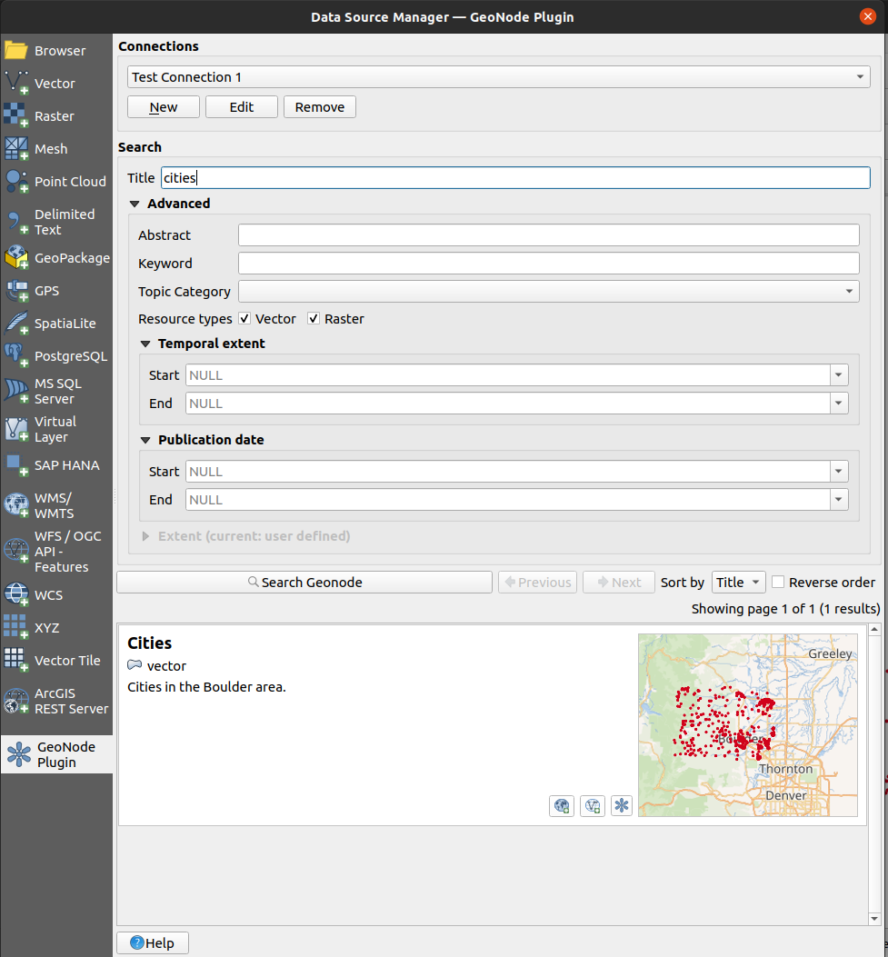
Once the search is complete a list of search results is shown below the
search buttons. If a large number of results has been found you may use the
previous and next buttons to paginate through the whole result set and
eventually inspect all of them. In this case, there is only one result.
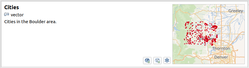
Each dataset shown on the search results list features the following elements:
Parameter |
Description |
|---|---|
Title |
The title of the dataset |
Dataset type |
Whether the dataset is a |
Abstract |
Brief description of the dataset |
Thumbnail |
Small image representation of the dataset |
Load layer via WMS |
Button to allow loading the dataset onto QGIS as a WMS layer |
Load via WFS/WCS |
Depending on the type of dataset, a button to load the dataset onto QGIS either as a WFS (for vectors) or WCS (for raster) layer |
Open dataset in web browser |
Button to open your web browser and visit the original dataset URL on the remote GeoNode instance |